Short Story
Green infrastructure (e.g., vegetated roofs, green facades, rain gardens, trees, parks, gardens, water bodies) can offset climate risks like heat, fire, flooding, pollution and various forms of illness, while creating conditions for biodiversity. Using high resolution satellite images and analysis by fully trained AI algorithms, this campaign aims to map existing and potential green infrastructure in towns and cities across BC. We have funding to map 15 km2 of the City of Vancouver, and your donation will allow us to expand.
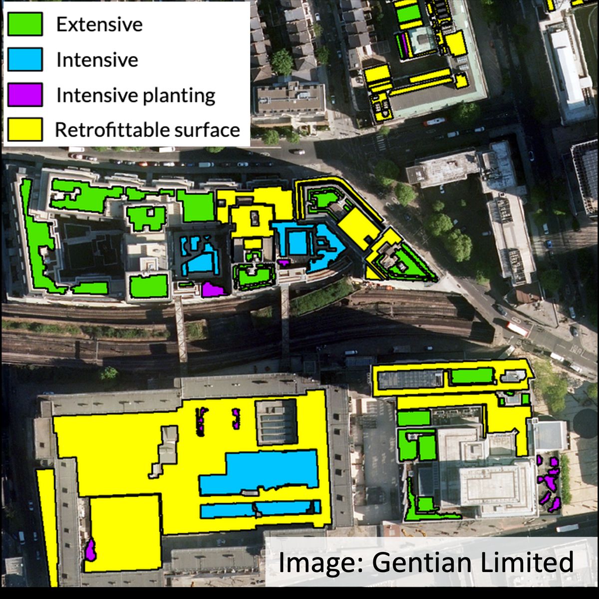
Mapping Vancouver’s Green Roofs and their Retrofit Potential
Story
Mapping existing and potential green infrastructure, including vegetated roofs, will grant planners, decision makers and stakeholders strategic clarity for how to respond to projected climate risks and vulnerabilities. As climate change progresses, with extremes projected to continue to intensify across BC, many municipalities face serious challenges and threats. The data and visuals produced by this project will support strategic decision-making on climate resilience for communities across BC.
As a pilot phase to develop the algorithms, we are funded to map 15 km2 of the City of Vancouver. Your donation will help us map more, including other communities across the province who are ready for climate action.
Since the roofscape accounts for about 30% of most cities’ land cover, green roofs offer significant opportunities for climate resilience. When combined with solar panels, green roofs can enhance renewable energy generation, as these systems function synergistically. Like other forms of green infrastructure, green roofs can:
- clean and cool the air and water,
- suppress fire,
- reduce greenhouse gas emissions,
- protect materials from degeneration,
- provide opportunities for urban agriculture and human well-being, and
- create conditions for biodiversity.
Using extremely high resolution satellite images, the software has been successfully applied in the United Kingdom, Europe and Japan. This will be its first application in North America. While the surveys are quick and cost-effective, funding is required to pay for the satellite images (proprietary); the generation and interpretation of the data, and to ensure the right people at the right organisations get the information that is needed for decision making, and setting measurable targets.
Your donation will help us map more of Metro Vancouver and eventually more BC communities across the province.
| Name | Donation | Date |
|---|---|---|
| Tony Valente | $50 | June 9, 2024 11:02 pm |
| AMY CHOMOWICZ | $10 | June 4, 2024 2:04 pm |